
Activities here
🥾Hiking· In season
🚵MTB· In season
⛷️Skiing· Off-season
This week
🥾 Today
Hiking · Poor · Sunny & dry
⛰️ 1224m → 3243m
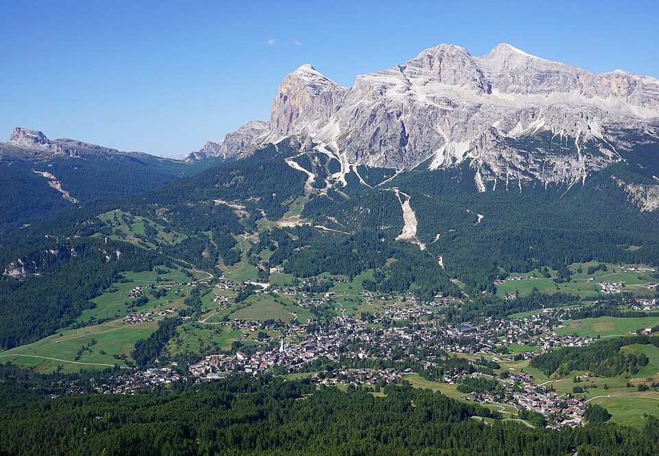
A ski resort in the Alps offering downhill skiing, snowboarding and winter sports for all levels.
📈Cortina d'Ampezzo facts▾
⛰️
3243m
peak
↕️
2019m
vertical
7-Day Forecastat 3243 m
Today
🟡 Too hot
⚠️ Low snow
17 Sat
🟡 Too hot
⚠️ Low snow
18 Sun
⚠️ Low snow
19 Mon
⚠️ Low snow
20 Tue
⚠️ Low snow
21 Wed
⚠️ Low snow
🌧️ Heavy rain
22 Thu
⚠️ Low snow
❄ Snow depth+cmFresh snow2h precip (white=snow, blue=rain)Tile color = daily score (red→green)
Detailed numbers▾
| Day | ⛷️ Score | 🌡️ Temp | ☀️ Sun | ☁️ Cloud | ❄️ Snow | 🌨 Powder | 🌧 Rain | 💨 Wind |
|---|---|---|---|---|---|---|---|---|
| → Today | 1.0 | -6°C | 5°C | 10.0 h | 57% | ⚠️ — | — | — | 6 km/h |
| Sat, Oct 17 | 1.0 | -5°C | 3°C | 9.2 h | 50% | ⚠️ — | — | — | 6 km/h |
| Sun, Oct 18 | 0.8 | -5°C | -1°C | 5.9 h | 86% | ⚠️ — | — | — | 10 km/h |
| Mon, Oct 19 | 0.8 | -4°C | 1°C | 9.3 h | 91% | ⚠️ — | — | — | 10 km/h |
| Tue, Oct 20 | 0.7 | -3°C | 0°C | 6.9 h | 92% | ⚠️ — | — | — | 10 km/h |
| Wed, Oct 21 | 0.6 | -5°C | -3°C | 0.0 h | 99% | ⚠️ — | — | 12.3 mm | 8 km/h |
| Thu, Oct 22 | 0.6 | -6°C | -3°C | 1.0 h | 94% | ⚠️ — | — | 1.2 mm | 8 km/h |
Access & Logistics
▾
✈ Airport
VCE · Venice Marco Polo
2h 10m
🚆 Train
Calalzo di Cadore
35 km bus connection — no direct train
🅿️ Parking
Several free + paid lots near the gondolas; Olympic ice stadium has the largest
📅 Season
1 Dec – 10 Apr
Drive time
Venice·2h 10m
Innsbruck·2h 30m
Munich·4h 30m
💡 Local insights
- ·Hosting Winter Olympics 2026 with Milan — major lift upgrades just completed.
- ·Tofana, Cinque Torri, Lagazuoi — three separate sectors, the Dolomiti Superski pass covers all.
- ·Via Ferrata Brigata Tridentina and Ivano Dibona are world-class; both need K3+ skill.
- ·Lunch at Rifugio Lagazuoi for the best Dolomite panorama; book the sunset terrace.
📊Best months & climate▾
More details elsewhere
Piste maps, trail maps, and third-party planners.
▾
More details elsewhere
Piste maps, trail maps, and third-party planners.