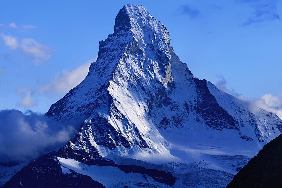
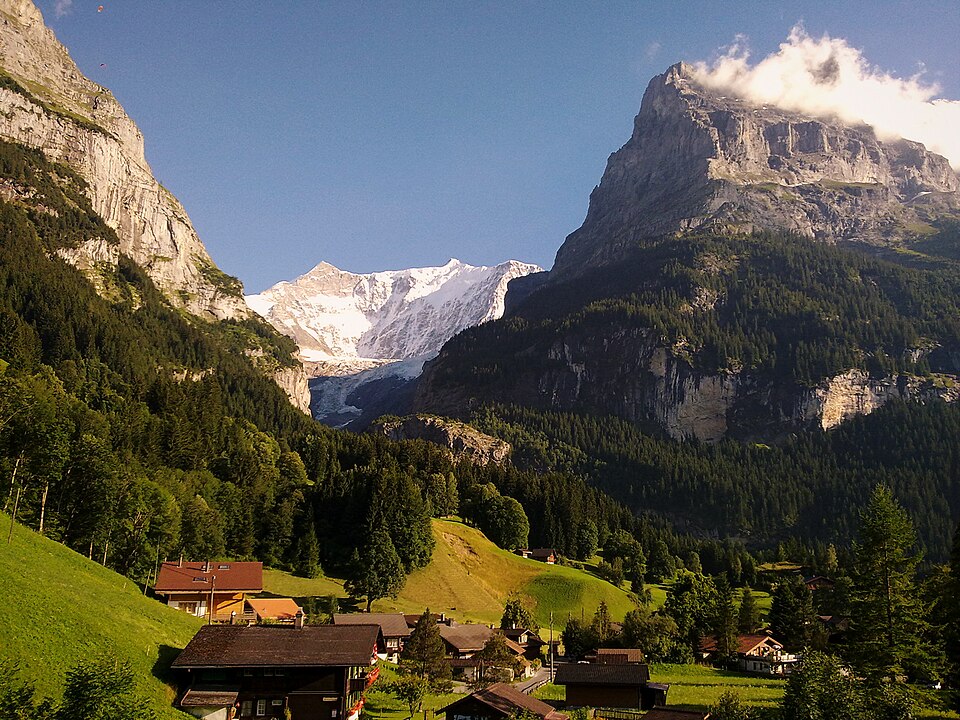
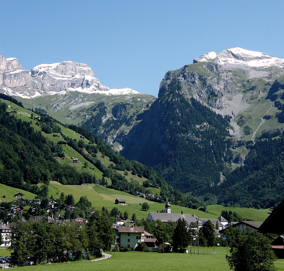
The Alps offer the finest hiking in Europe. Over 180,000 km of marked trails wind through flower-filled meadows, past crystal-clear lakes, over dramatic passes and up to some of the most spectacular summits on earth. From the famous Tour du Mont Blanc to the hidden gems of the Dolomites — every step is a postcard.
With a legendary network of mountain huts serving hot meals at 3,000 meters, the Alps make multi-day trekking accessible to everyone. Whether you're a gentle walker seeking panoramic views or an experienced mountaineer targeting 4,000-meter peaks, this guide helps you find the perfect trail for your ability and ambition.
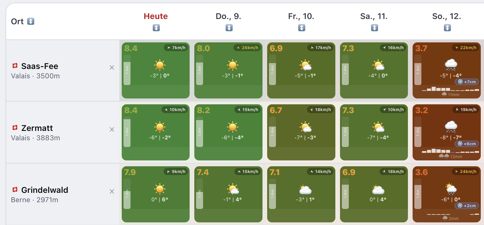
The trail marking system is consistent across the Alps: yellow signs indicate wanderwege (easy hiking paths), white-red-white marks bergwege (mountain trails requiring sure-footedness), and white-blue-white marks alpinwege (alpine routes requiring climbing skills). Always check the weather before heading out — conditions change rapidly above 2,000m.
Hut-to-hut trekking is the quintessential Alpine experience. Book huts in advance during July-August (the SAC and DAV apps make this easy). Bring a sleeping bag liner, cash for hut meals, and start early — afternoon thunderstorms are common in summer.
📅 When to Go
The Alps hiking season runs from June to October, with peak conditions in July-September. Snow lingers on high passes (above 2,500m) until July. June offers wildflowers but some passes remain closed. September-October brings stable weather, fall colors, and fewer crowds — arguably the best time to hike.
🎒 What to Pack
- ✓ Waterproof hiking boots (broken in!)
- ✓ Rain jacket + warm layer (weather changes fast)
- ✓ Trekking poles (essential for descents)
- ✓ Sun protection: hat, sunscreen, sunglasses
- ✓ Hut sleeping bag liner + headlamp
- ✓ 1.5L water + trail snacks
- ✓ Paper map of your route (don't rely solely on phone)
💡 Pro Tips
Start hikes before 8am — afternoon thunderstorms above 2,000m are common in summer.
Book mountain huts 2-4 weeks in advance for July-August. Many fill up completely.
The best panoramic hikes are often the easiest: Eiger Trail, Five Lakes Walk, and Aletsch Glacier Viewpoint are all moderate.
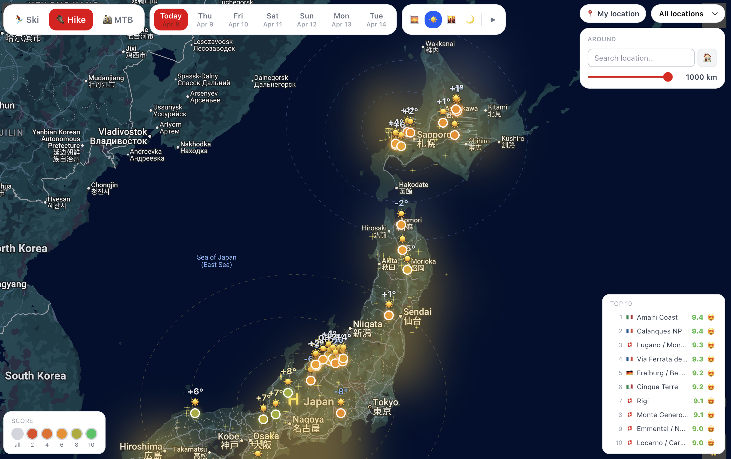
Use Ski Kavallerie's sunshine and wind scores to pick the clearest day — visibility makes or breaks a summit hike.
Powered by Ski Kavallerie
Real-time data for 385+ locations worldwide
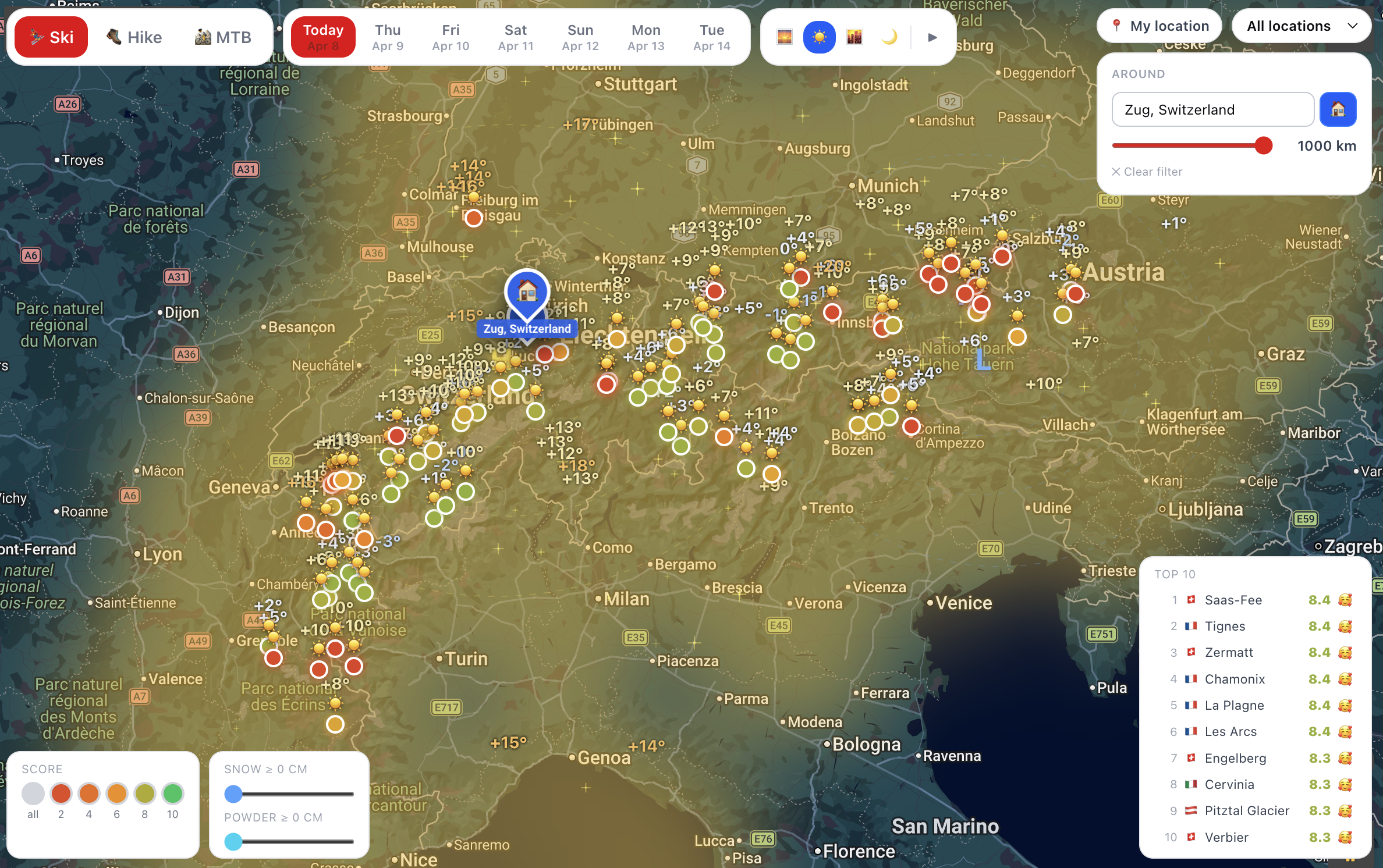
Top Guida Escursionismo Locations
Ranked by community popularity
Iconic Tracks
Legendary routes that define the region
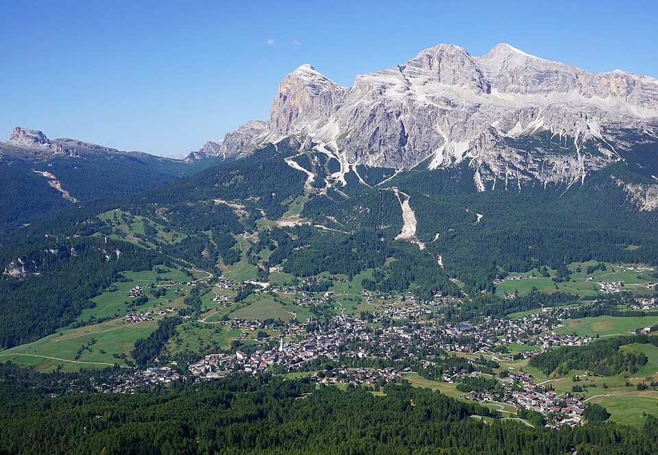
Walk beneath the towering Odle/Geisler spires — the most photogenic trail in the Dolomites
Walk along the UNESCO Great Aletsch Glacier — the longest glacier in the Alps (23 km)
The classic Dolomites high route — 8-13 days from Lago di Braies to Belluno through dramatic spires
The harder Dolomite traverse — Bressanone to Feltre, 150km over 13 days through Puez-Odle, Sella, Marmolada and Pale di San Martino. More K3 via ferrata sections than AV1.
Walk across the iconic sandstone bridge 194 m above the Elbe — Germany's most dramatic viewing platform
Plan Your Next Adventure
Invite friends, create a trip and let weather scores guide your timing.
Guida Escursionismo by Country
Perfect Hiking Weather
Get alerts when trails hit ideal conditions. Clear skies, warm temps, zero rain.
Expert Guides
Explore More Guides
All sports, all regions